WMS Map Viewer 제작자: Pantelis Rodis
An application for viewing for web maps that use the WMS protocol
사용자 140명사용자 140명
확장 메타 데이터
스크린샷
정보
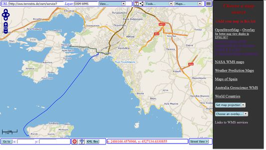
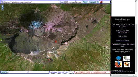
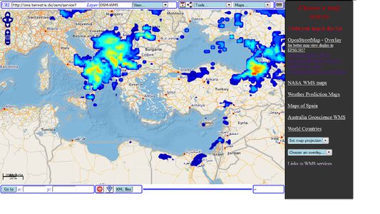
WMS Map Viewer is an advanced client for web mapping services that use the WMS protocol. That is interactive web maps from various sources. The application is compatible with all modern versions of web map protocols, ensuring an advanced and comfortable user experience. It is only necessary to input the URL of a WMS web service and the name of the layer that you wish to view and then you may view the map. The map layers that you open may be saved in HTML files for later use.
There are also built-in connections to popular and free WMS services of map and satellite data of OpenStreetMap, Spain, Australia and NASA.
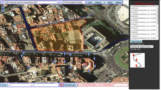
You may easily digitize points, lines or areas and export them as CSV or KML files.
There are also built-in connections to popular and free WMS services of map and satellite data of OpenStreetMap, Spain, Australia and NASA.
You may easily digitize points, lines or areas and export them as CSV or KML files.
5명이 5점으로 평가함
추가 정보
- 부가 기능 링크
- 버전
- 1.5resigned1
- 크기
- 218.08 KB
- 마지막 업데이트
- 2년 전 (2024년 4월 25일)
- 관련 카테고리
- 개인정보처리방침
- 이 부가 기능에 대한 개인정보처리방침 읽기
- 사용자 라이선스 동의서
- 이 부가 기능에 대한 사용권 계약 읽기
- 버전 목록
- 모음집에 추가